General Resource MapsRock County, Wisconsin |
Year |
Map |
Source |
Current |
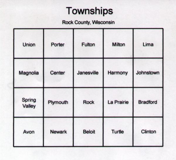
Layout of Townships in Rock County | WIGenWeb-Rock County |
| Graphical Display of the Federal Township and Range System |
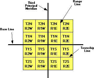
The largest grouping is the township which is named in reference to a Principal Meridian (P.M.) and a Baseline. T2N, R1E refers to Township 2 North (of the Baseline), Range 1 East (of the Principal Meridian).
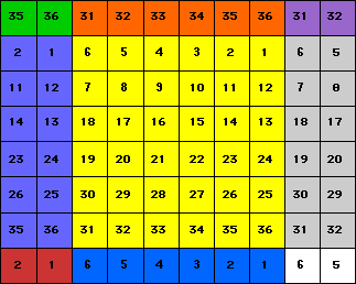
Within each township are 36 sections, each one mile square. Each section contains 640 acres. The sections are numbered from 1 to 36 in the following order.
Within each township are 36 sections, each one mile square. Each section
contains 640 acres. The
sections are numbered from 1 to 36 in the following
order:
     6  2  4  3  2  1
     7  8  9 10 11 12
    18 17 16 12 14 13
    19 20 21 22 23 24
    30 29 28 27 26 22
    31 32 33 34 32 36
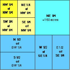
Within each section, the land is refered to as half and quarter sections. A one-sixteenth division is called a quarter of a quarter, as in the NW1/4 of the NW1/4. The descriptions are read from the smallest division to the largest.
|

