

Price County
WIGenWeb

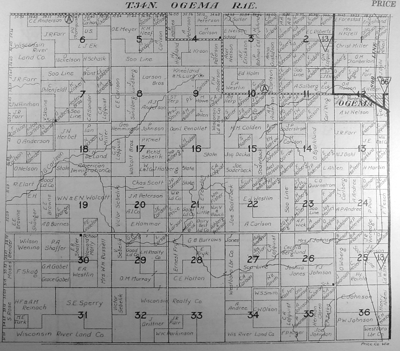
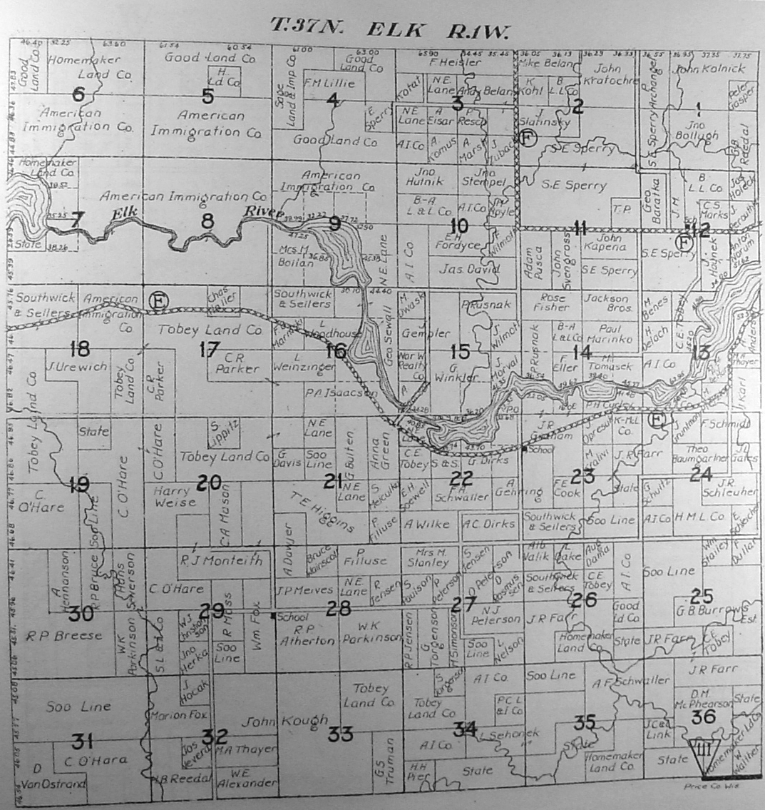
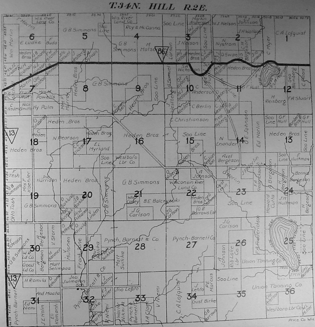
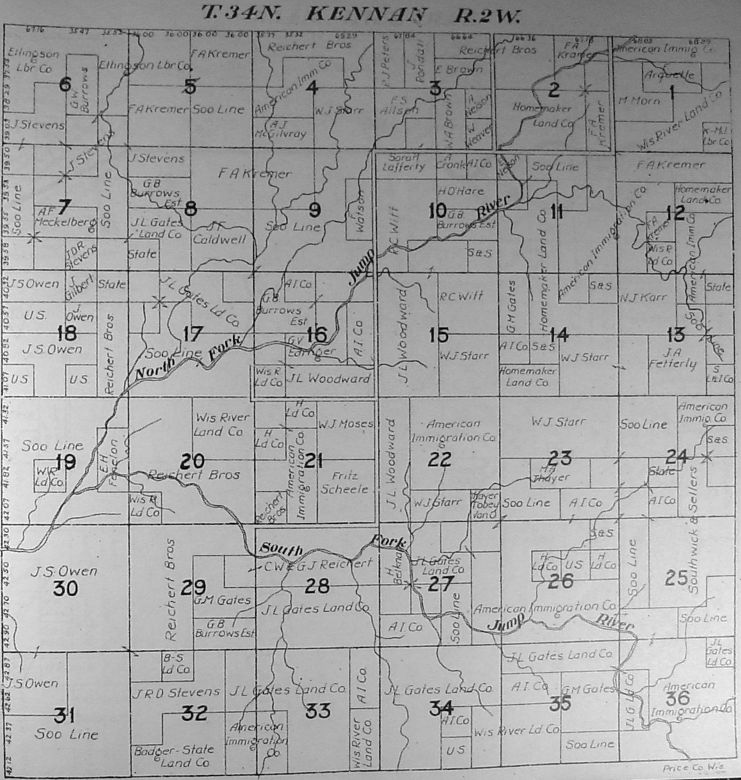
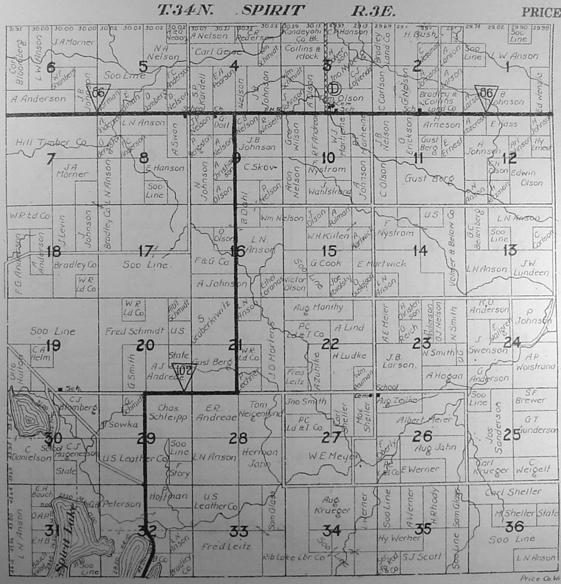
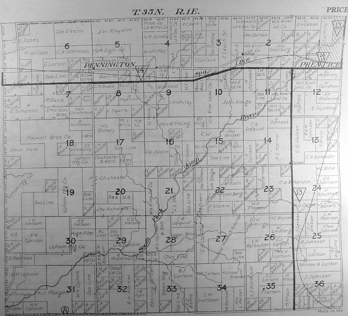
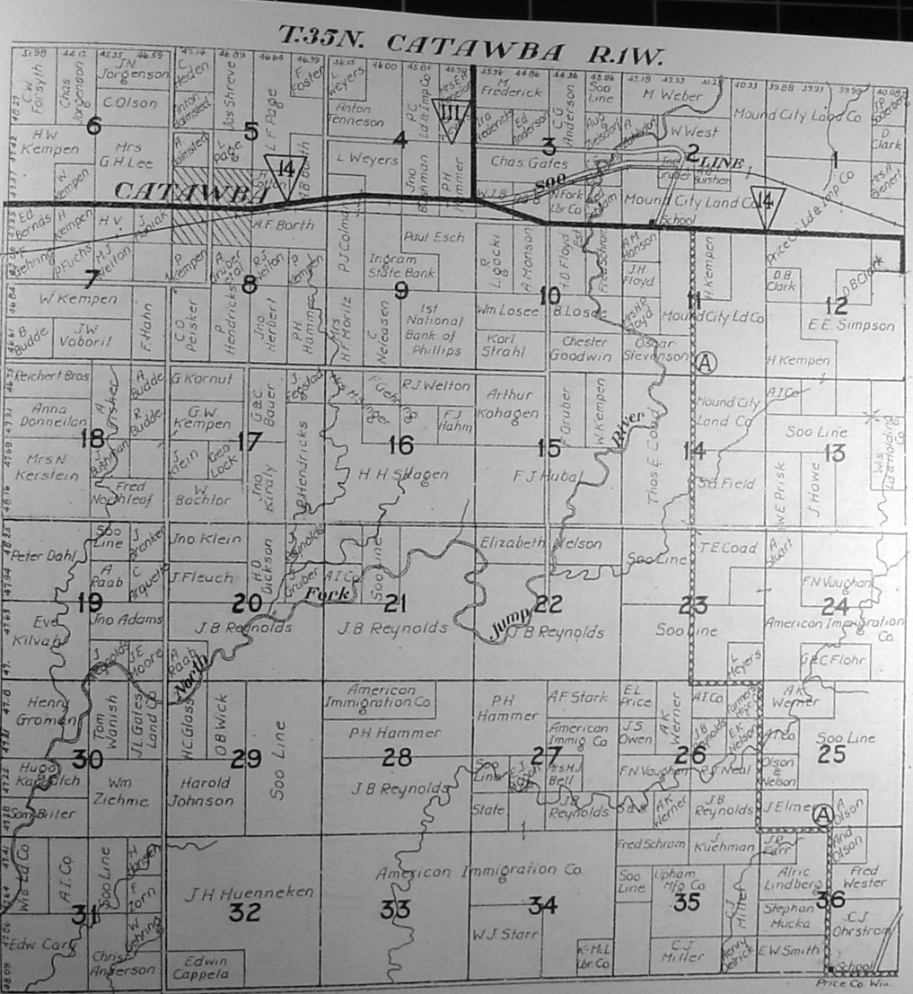
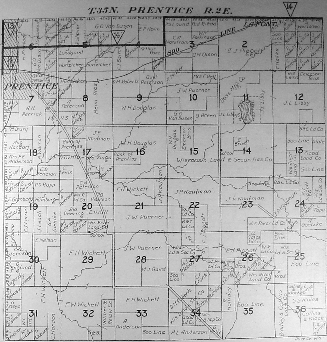
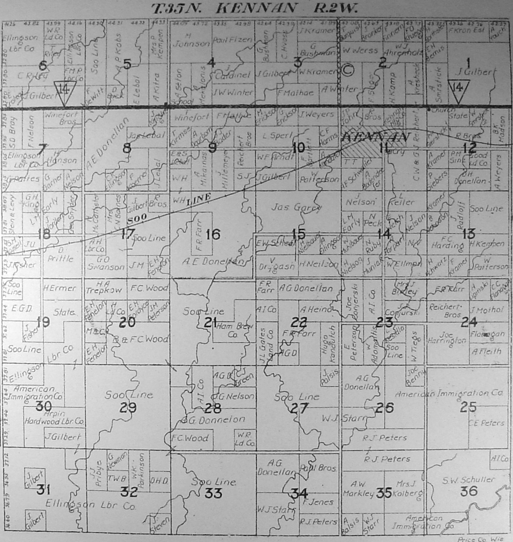
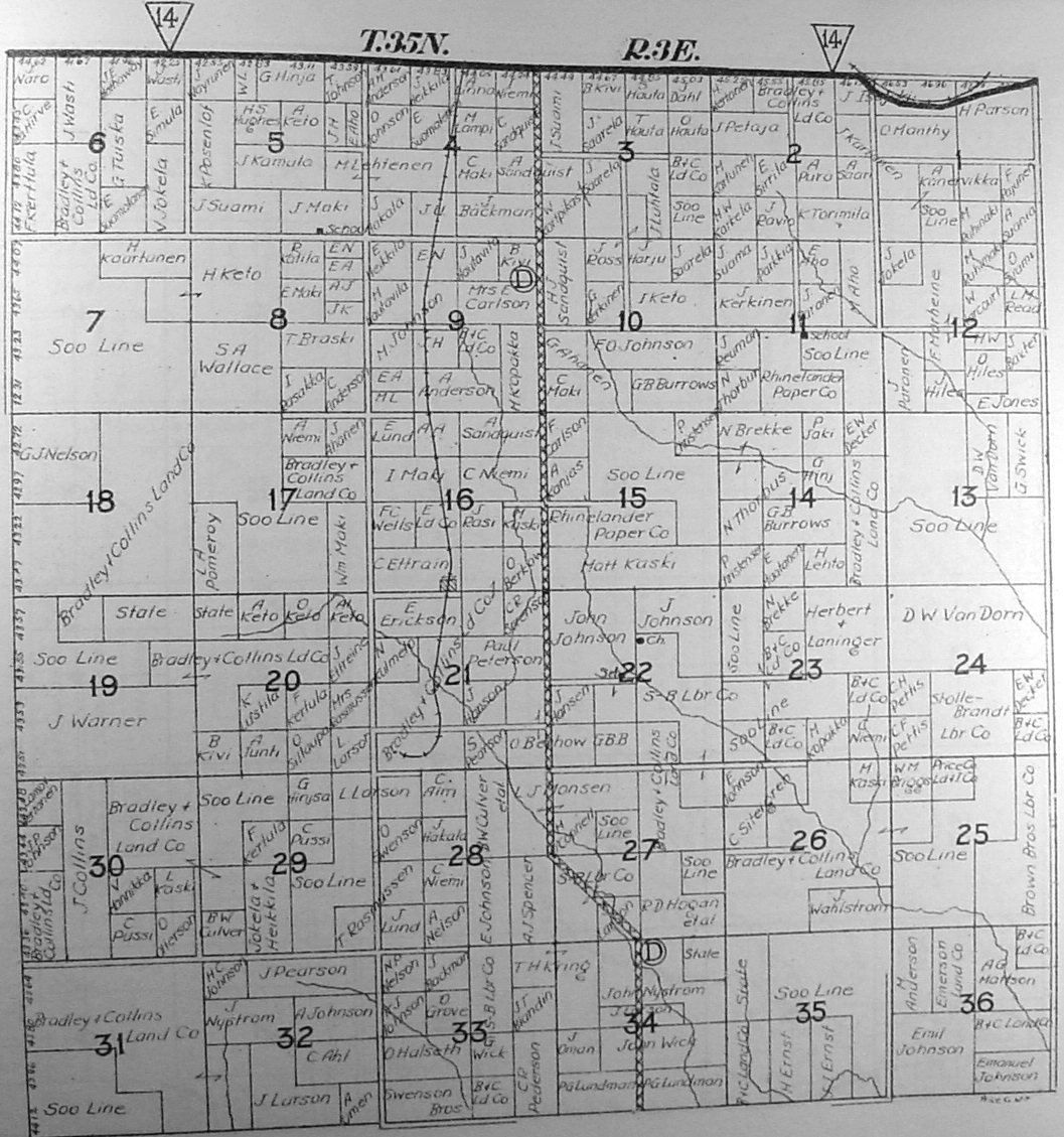
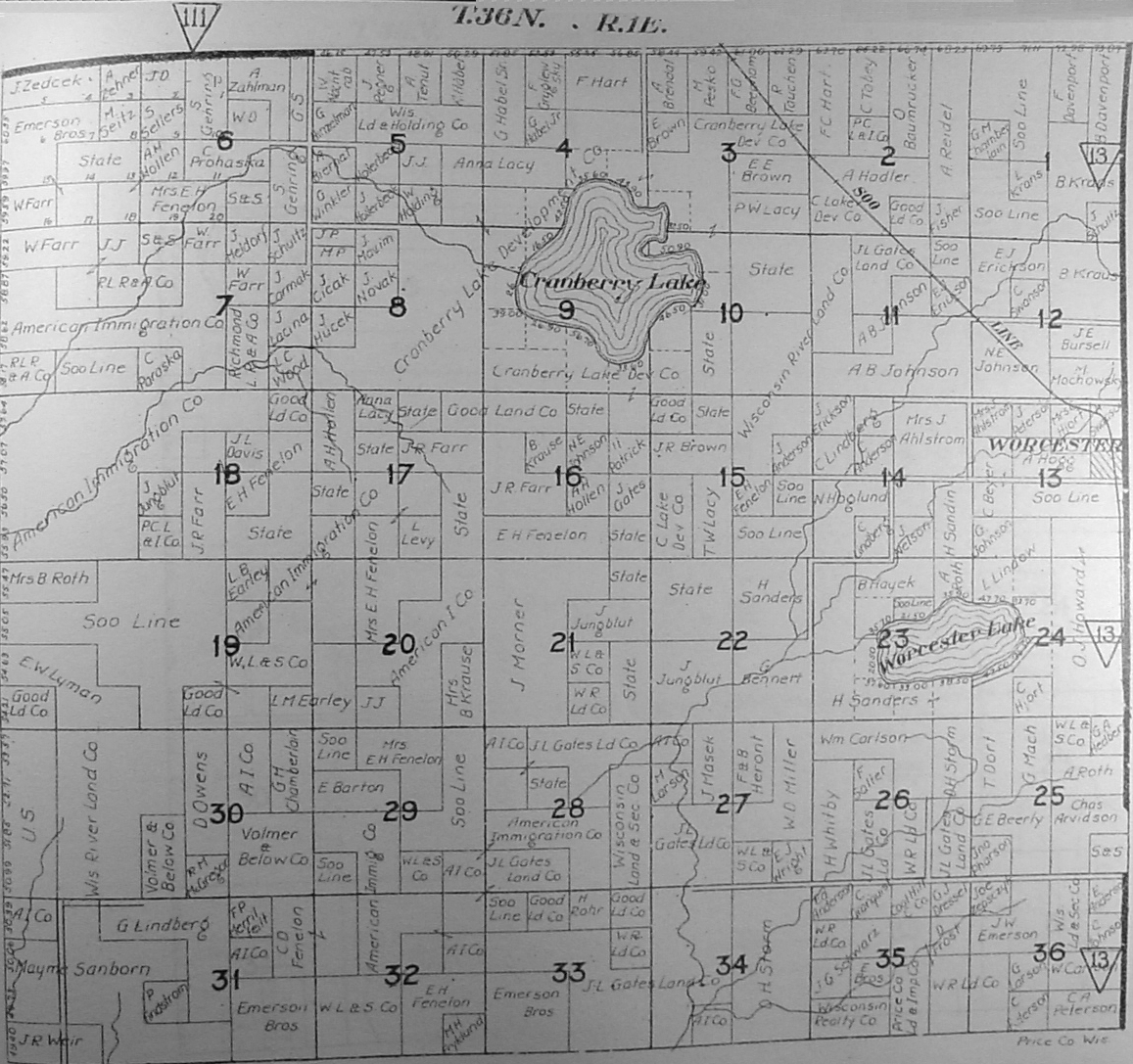
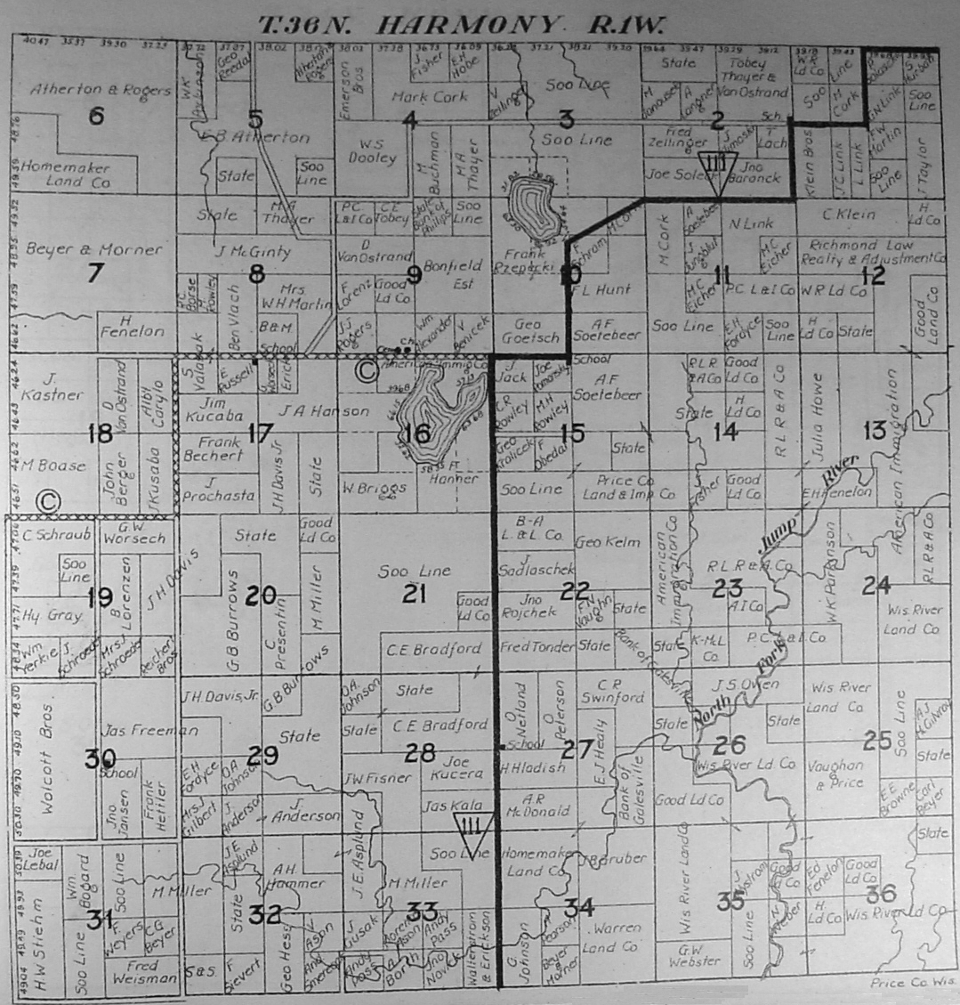
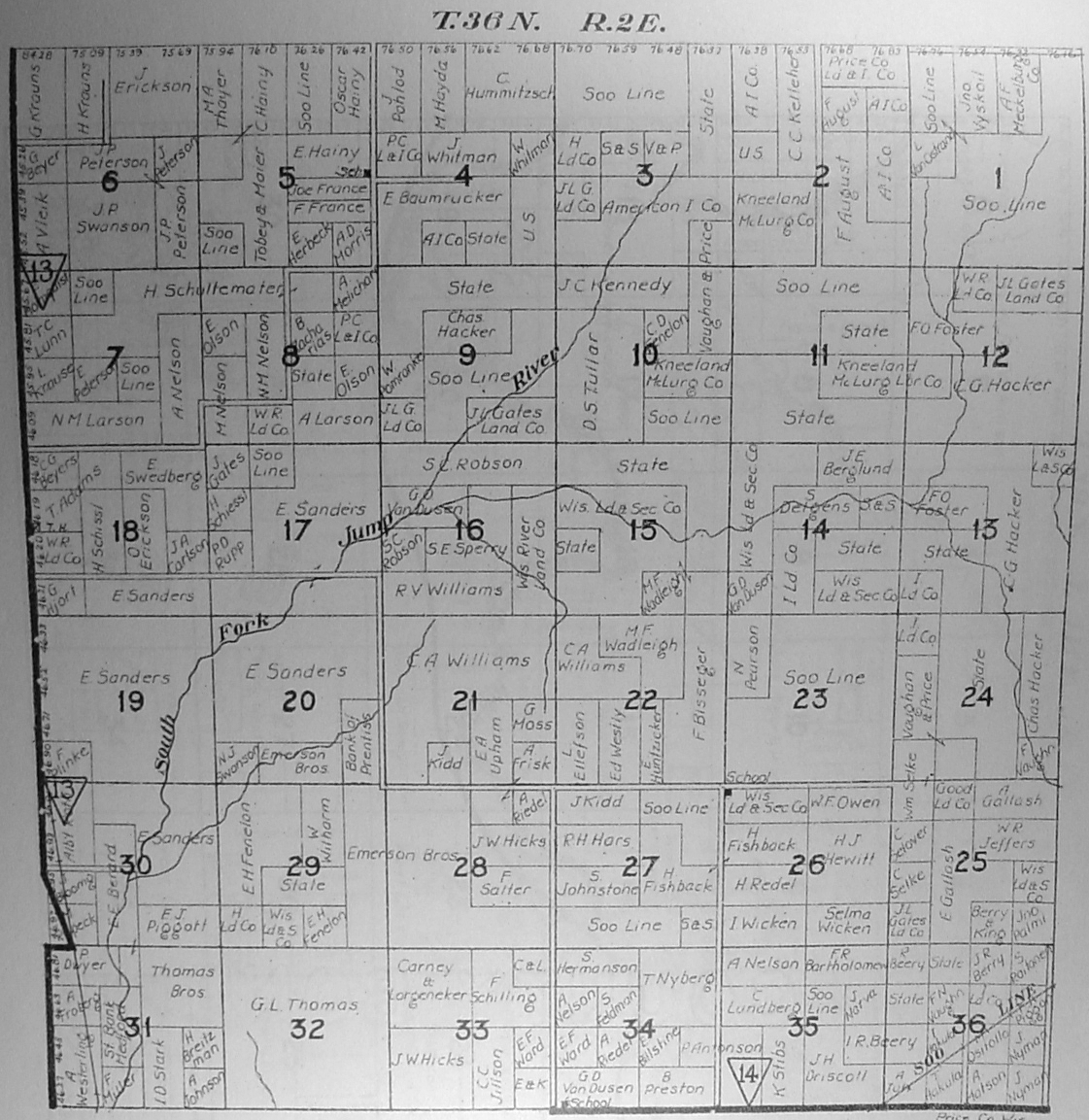
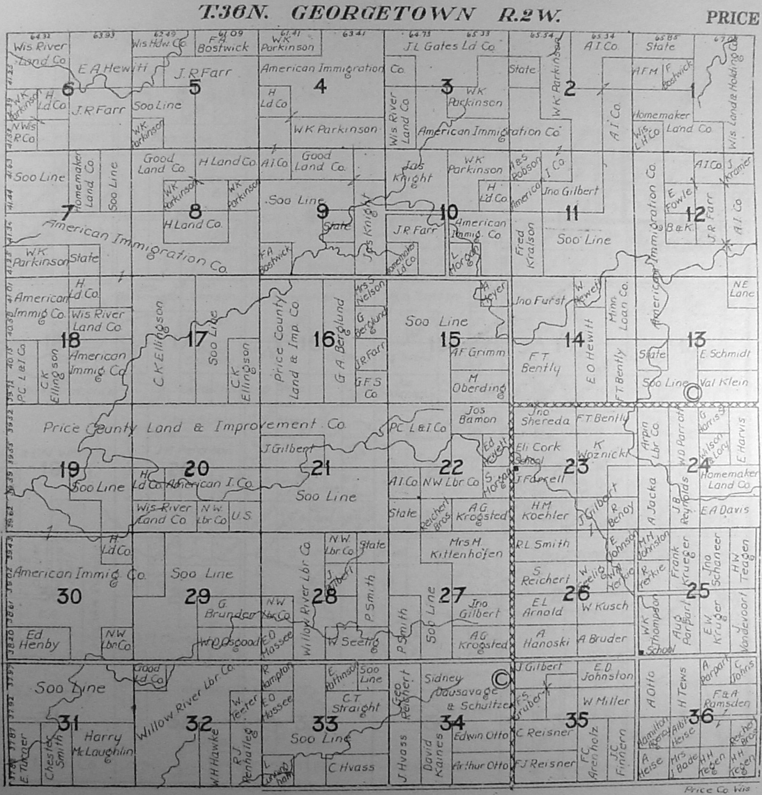
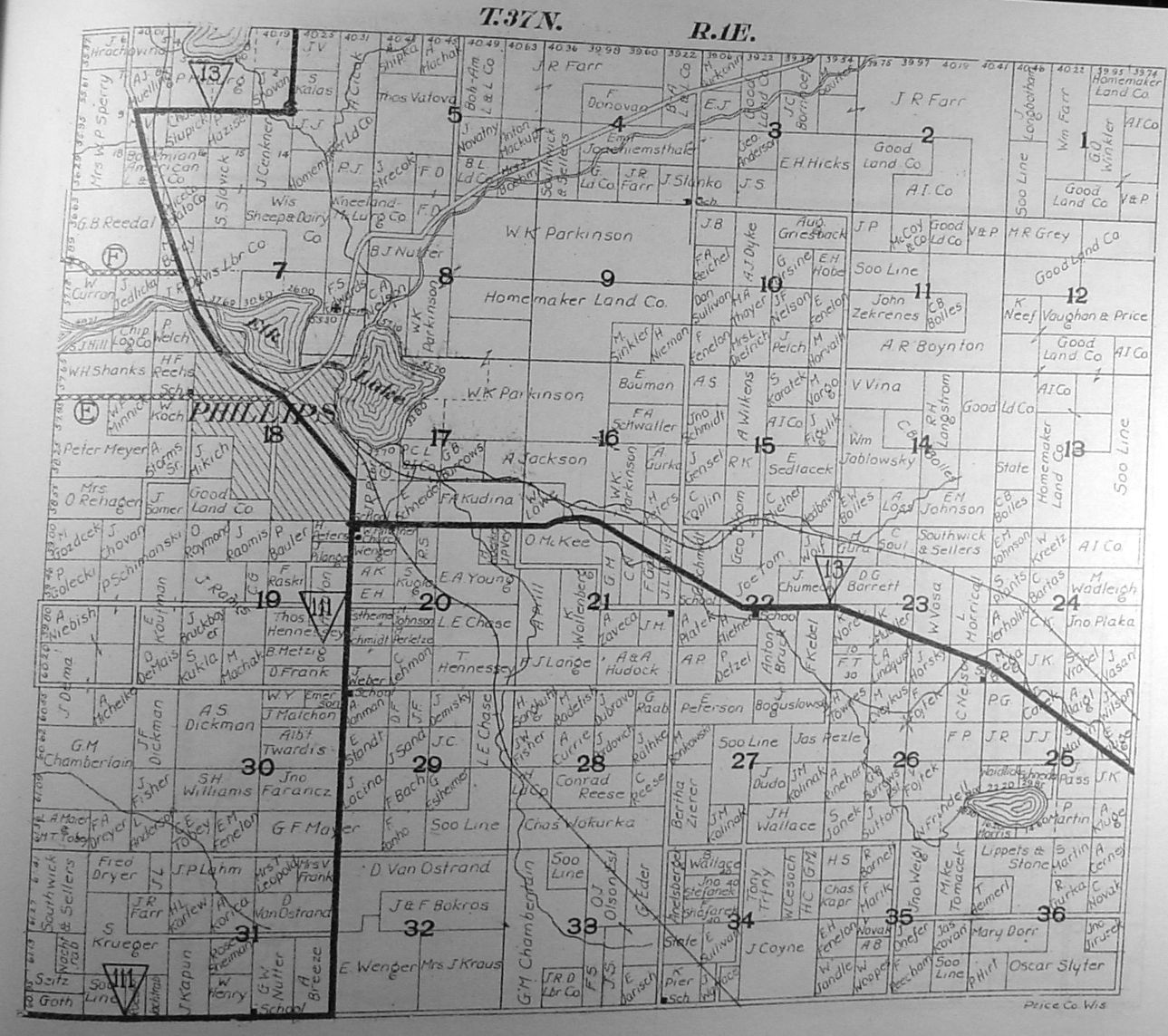
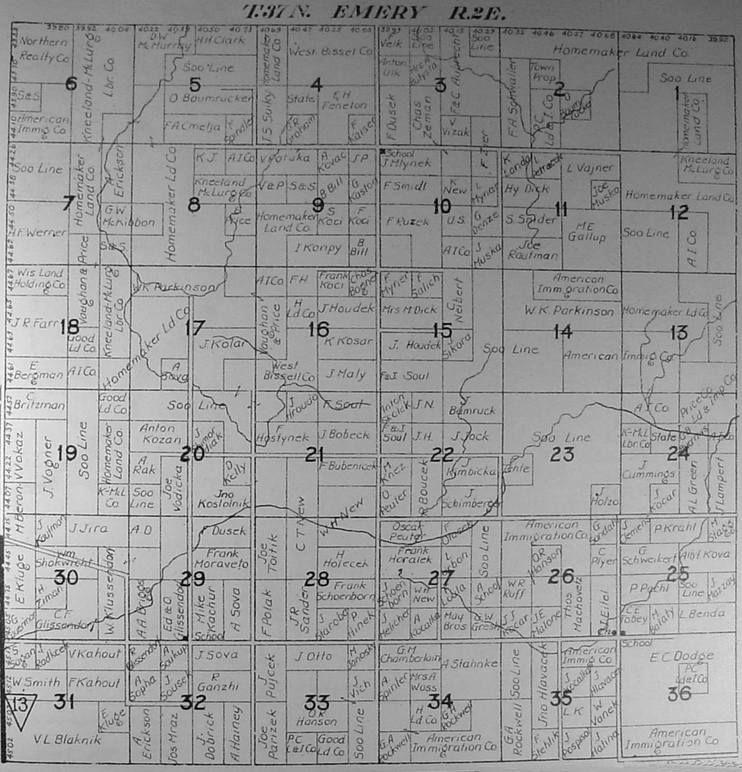
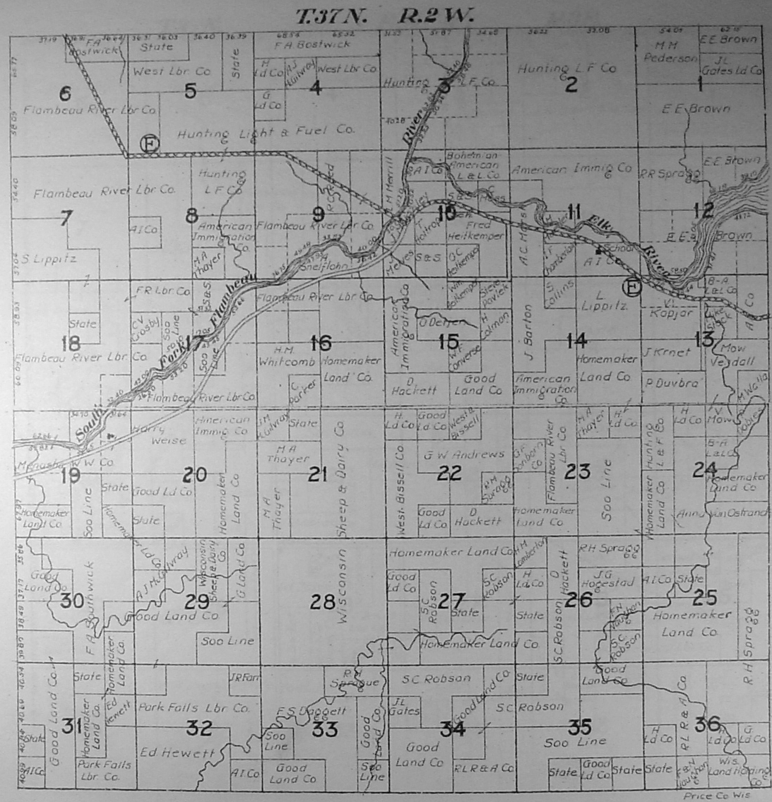
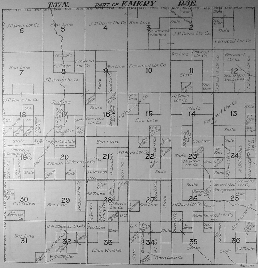
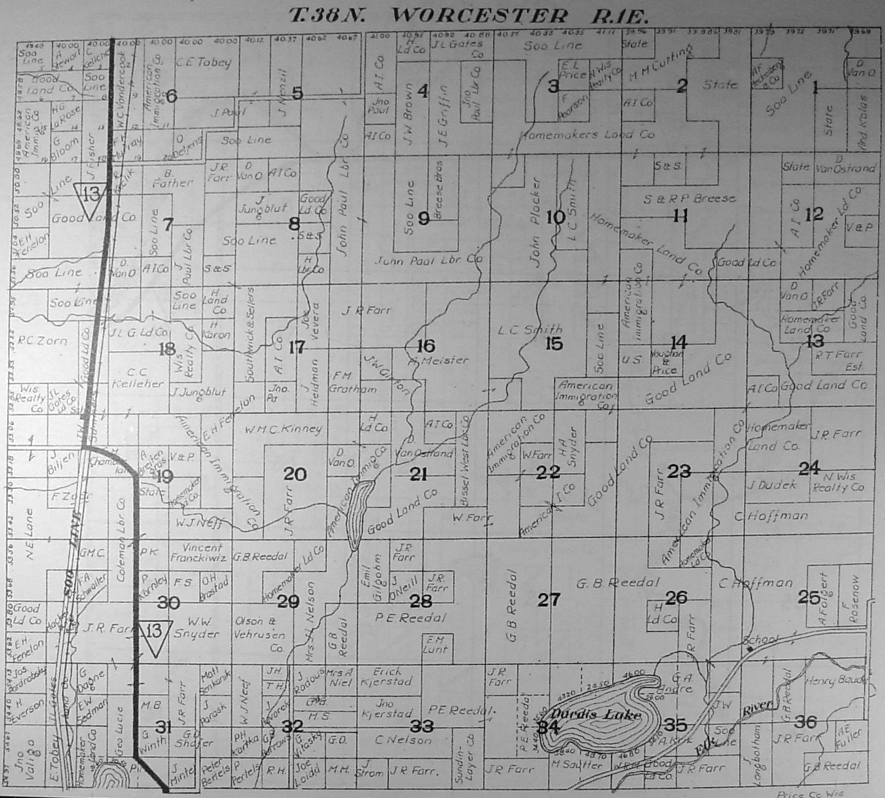
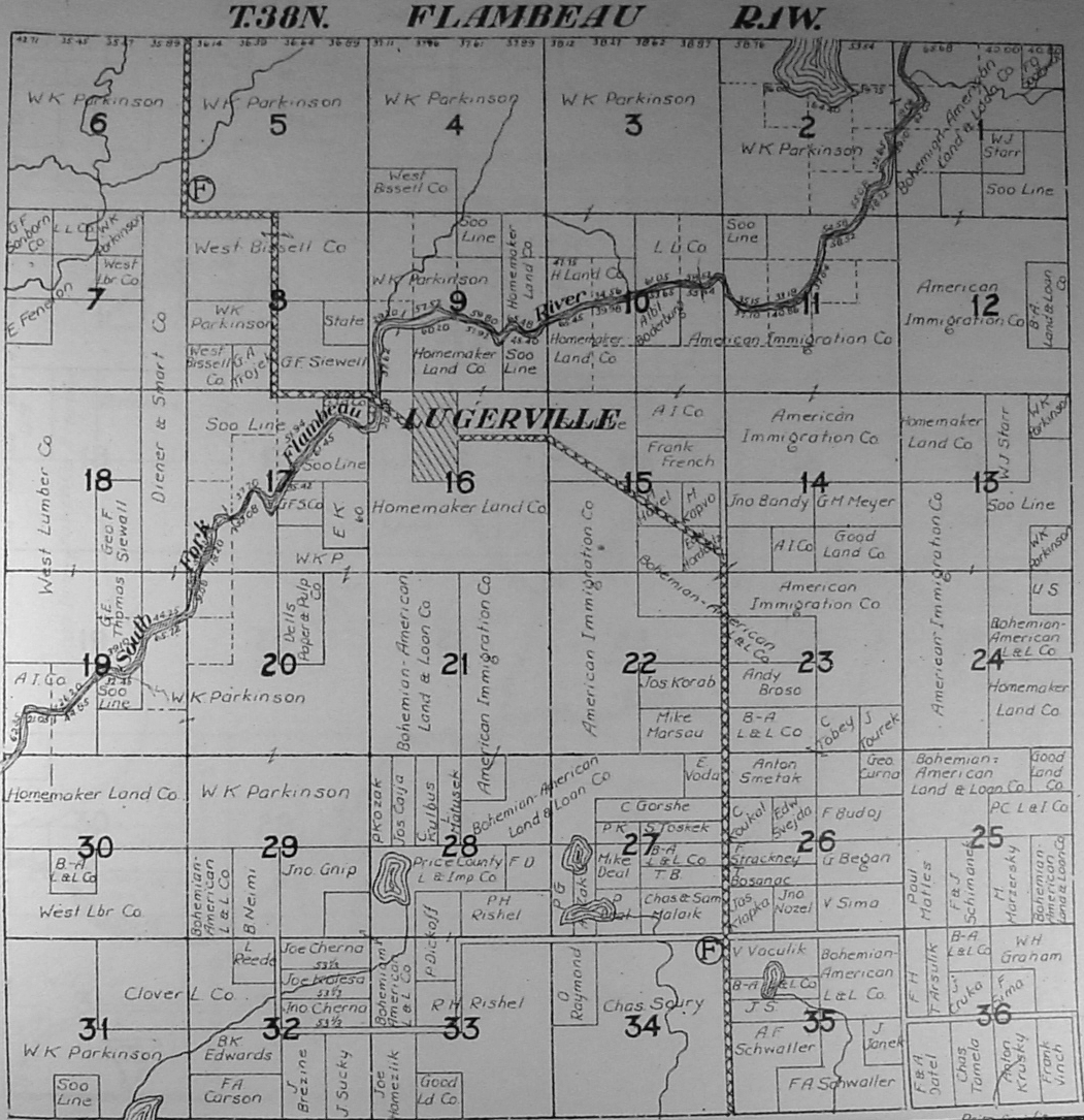
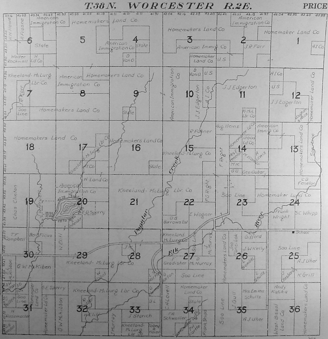
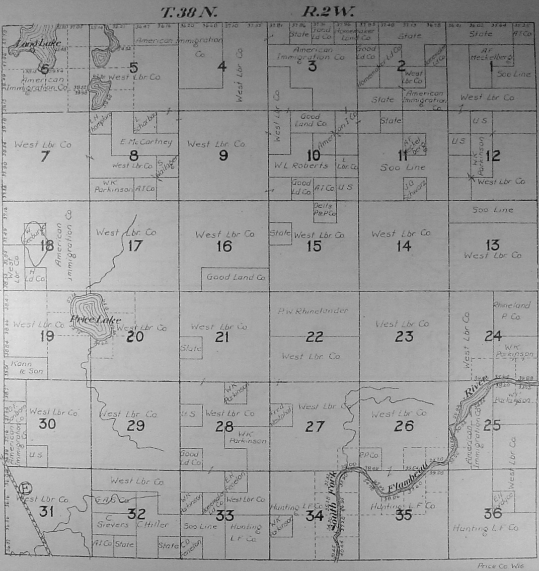
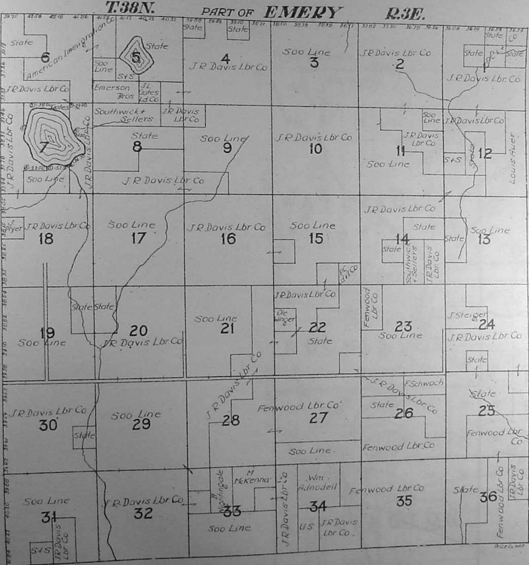
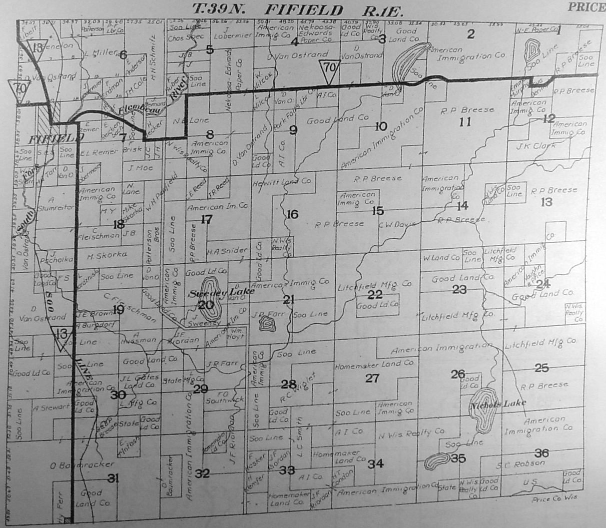
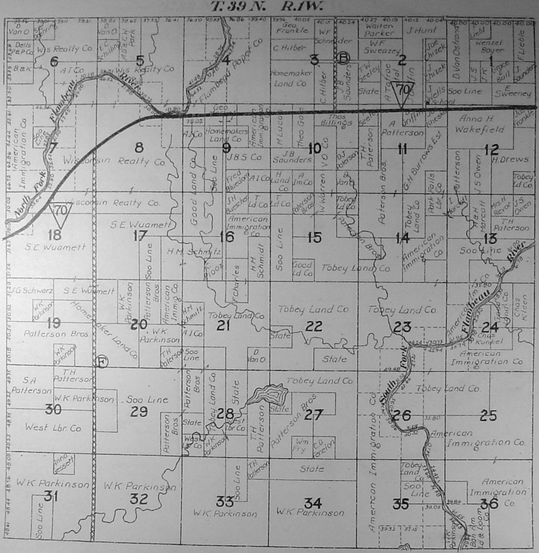
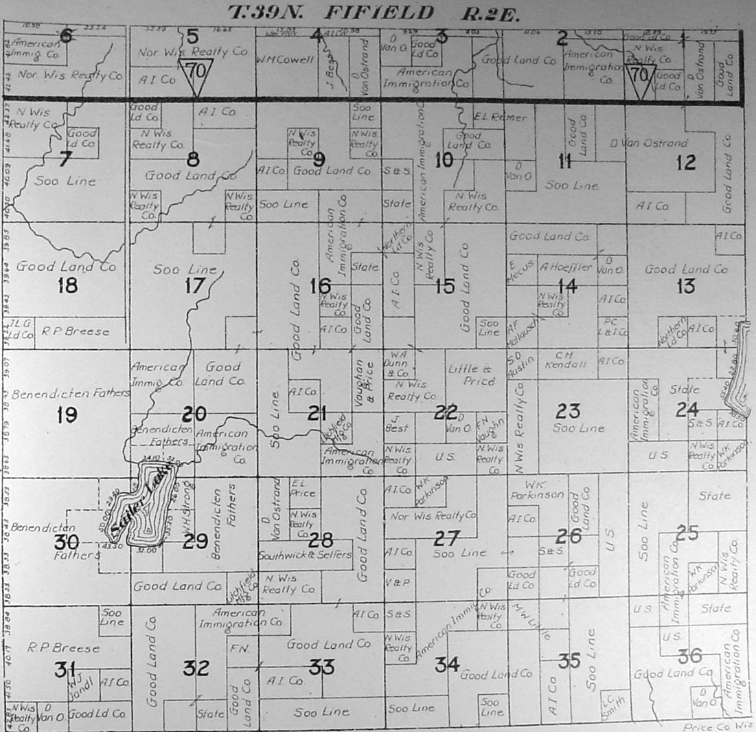
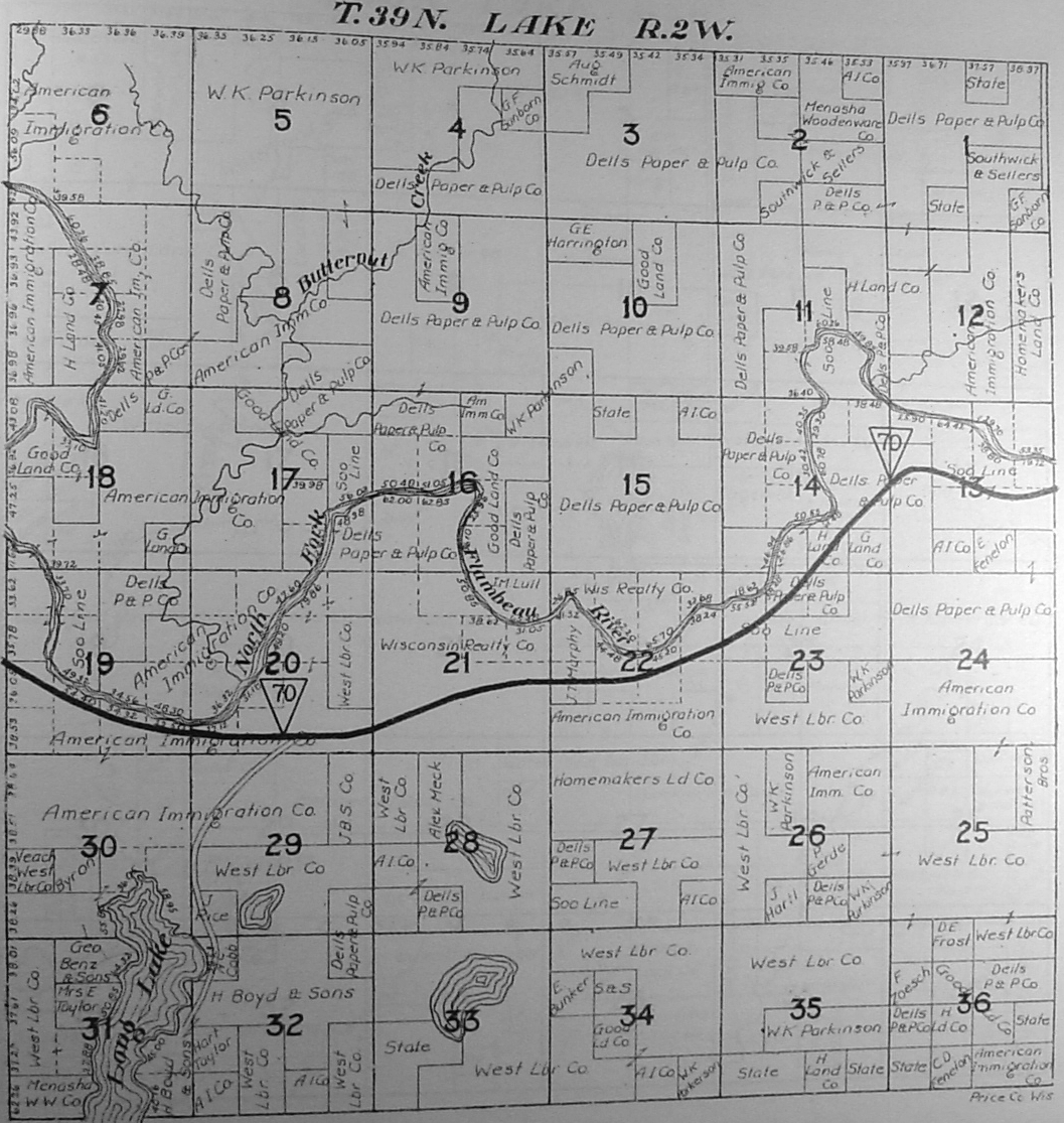
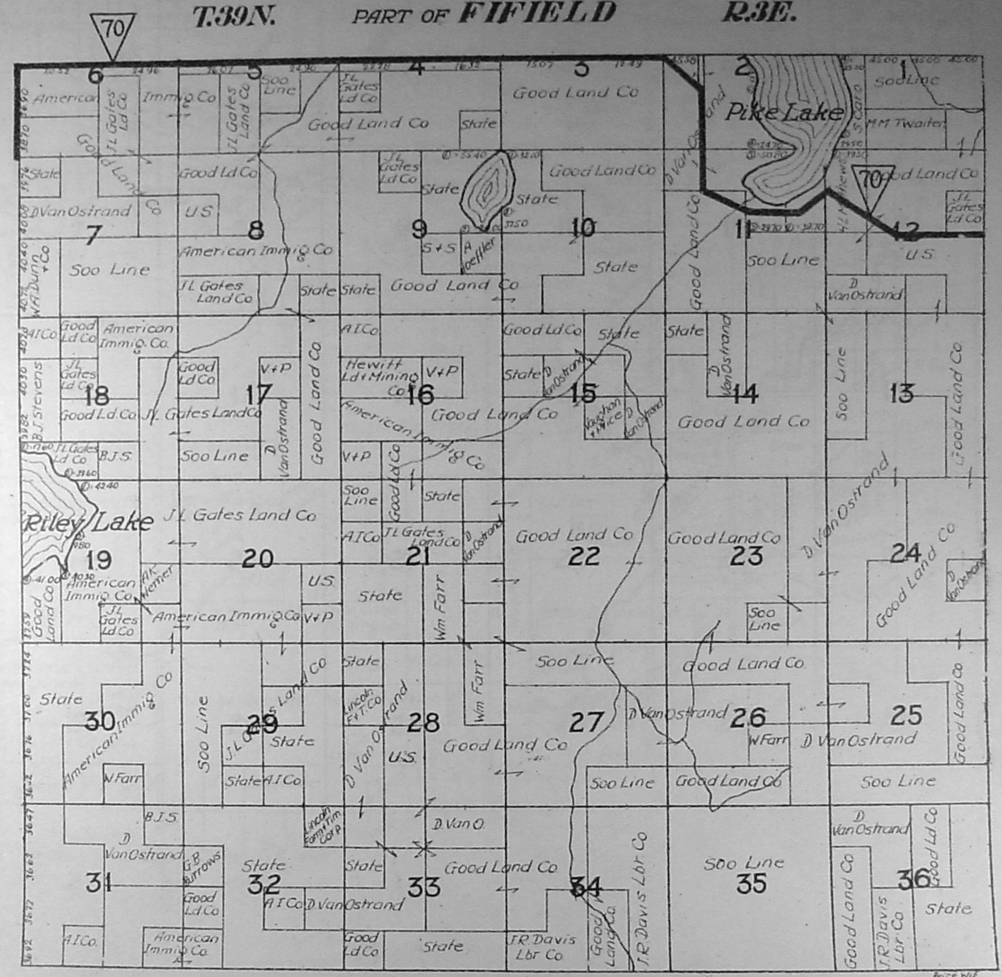
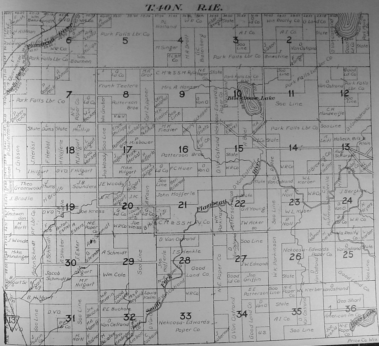
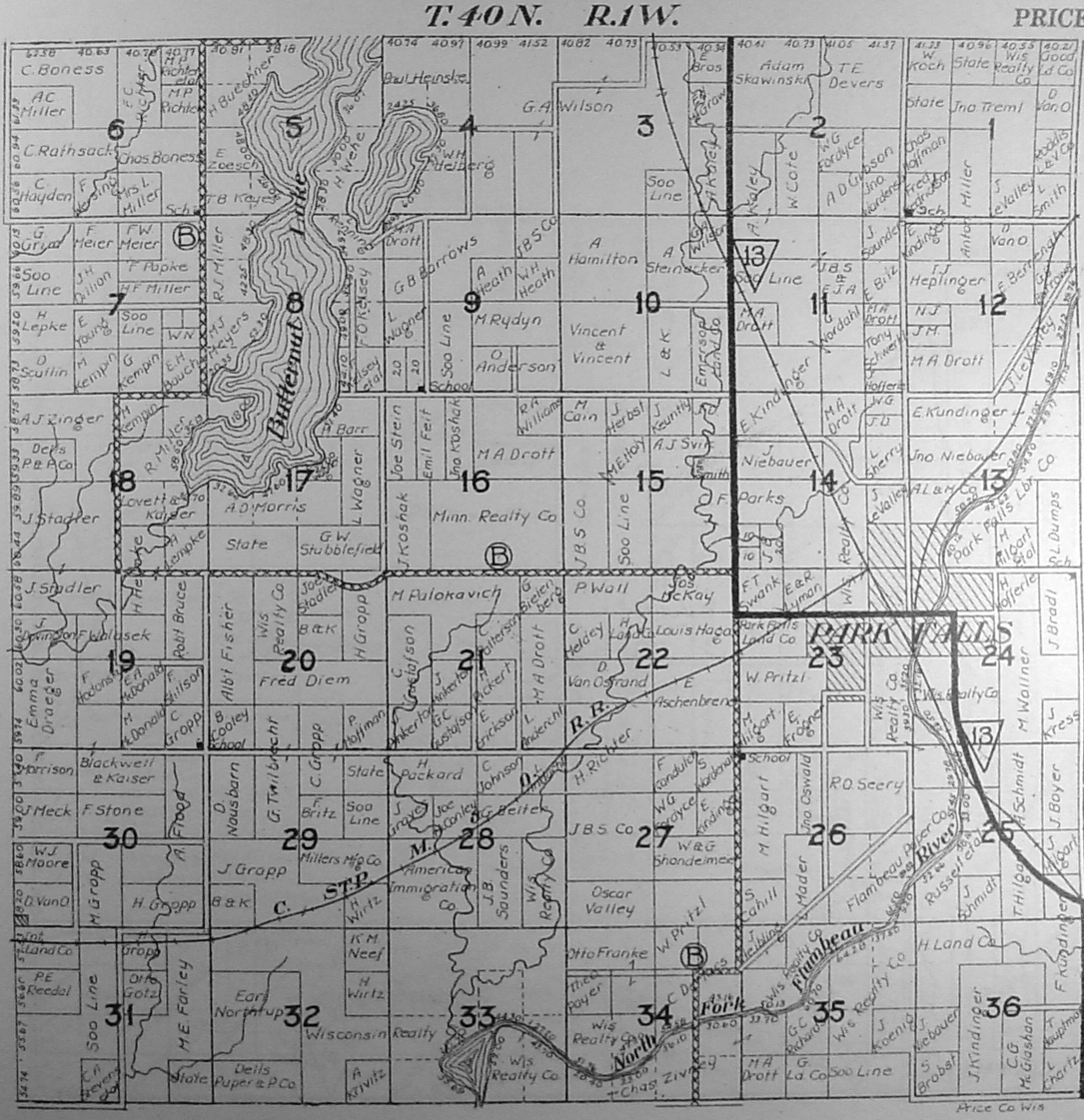
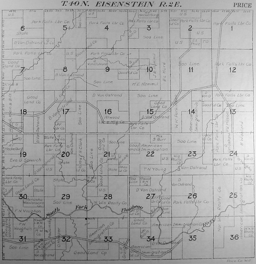
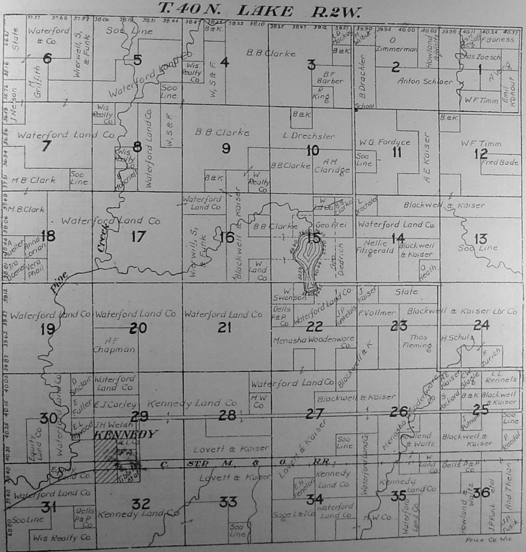
[This Platt is sometime after 1920, but exact date is unknown]
Click on Index Line to View Map
|
T35N - R3E (Knox) |
|
T36N - R3E (Includes north Brantwood) |
|
T37N - R1E (Includes areas around Phillips) |
|
Many thanks to Kim Potaracke, Chequamegon-Nicolet Nation Forest Service for donating all the Platt images for this site!!!
|
Copyright © 1996 - The USGenWeb® Project, WIGenWeb, Price County
Design by Templates in Time
This page was last updated 12/24/2024