 |
Maps
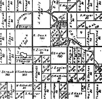
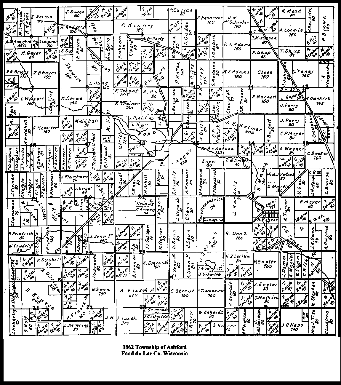
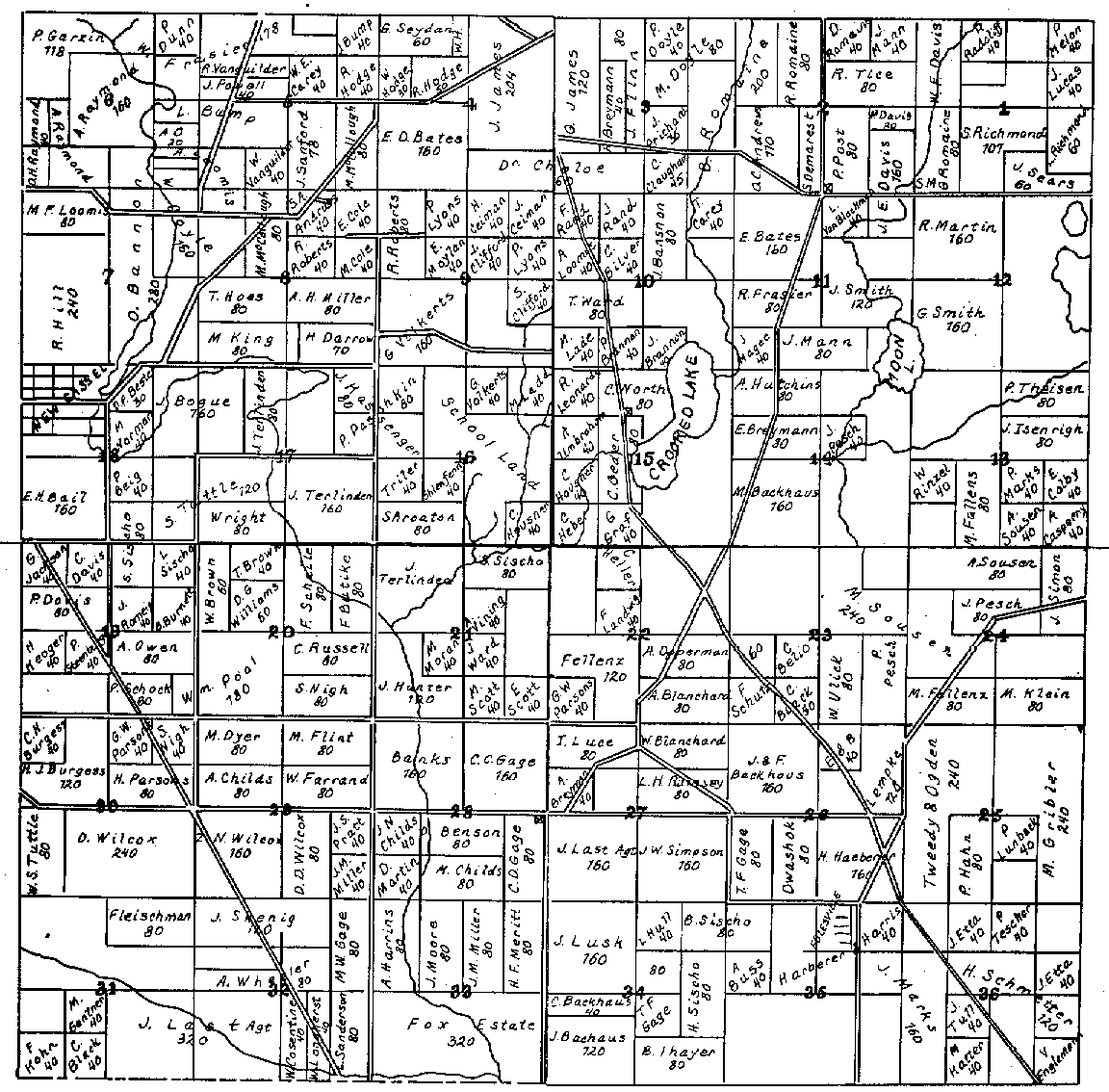
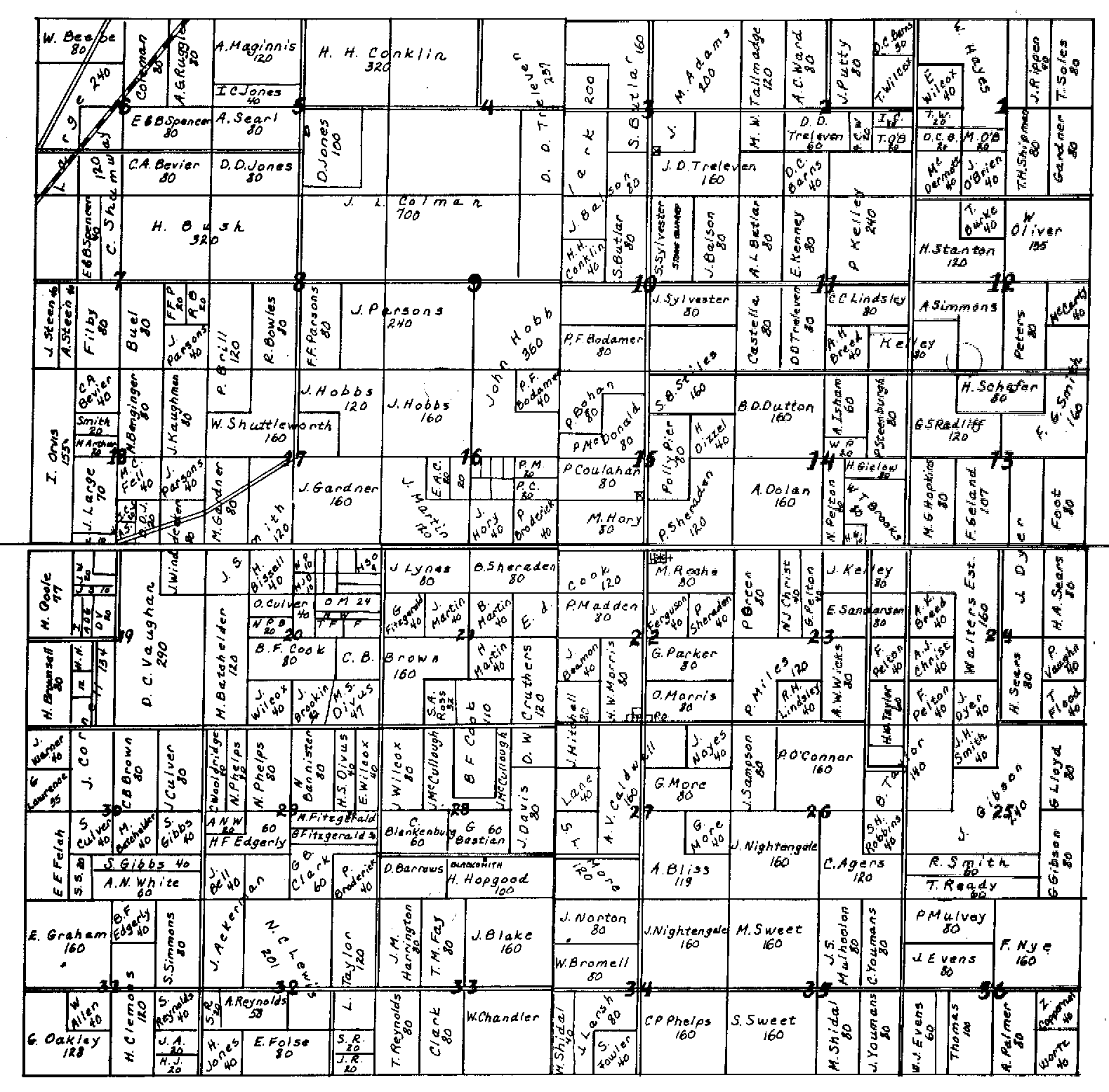
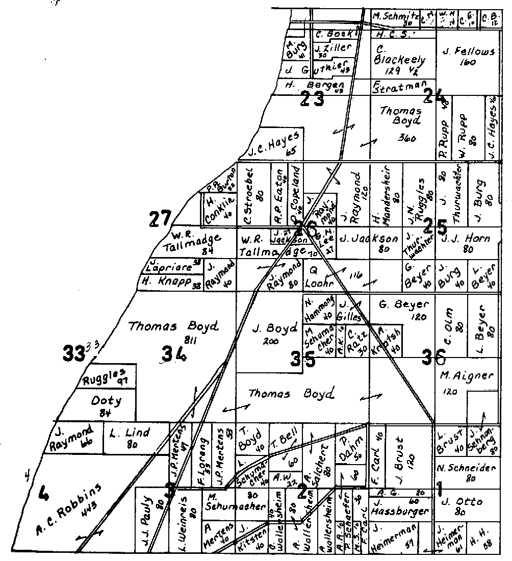
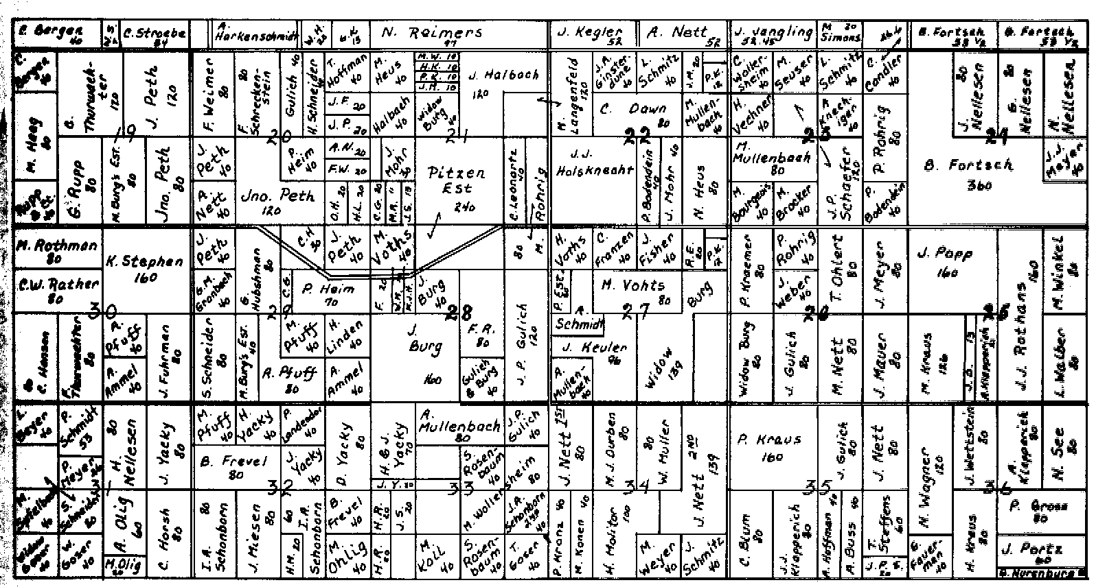
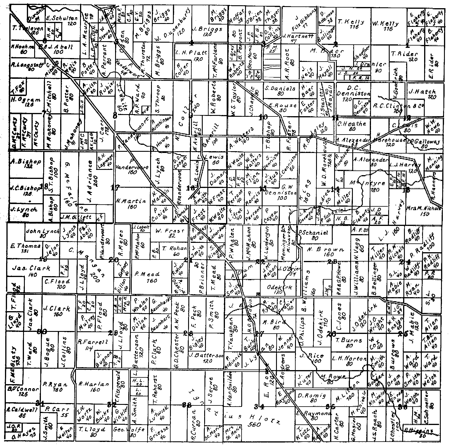
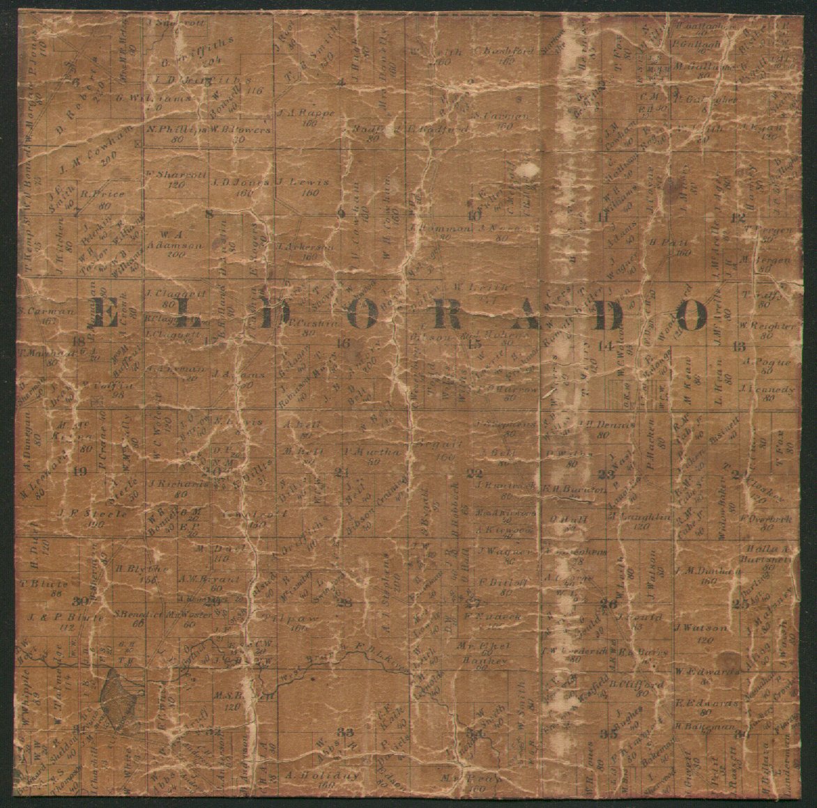
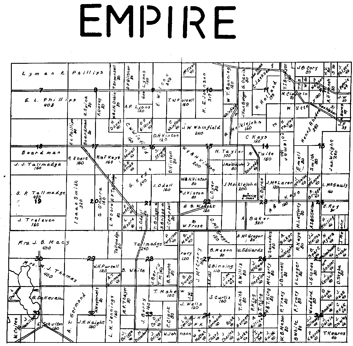
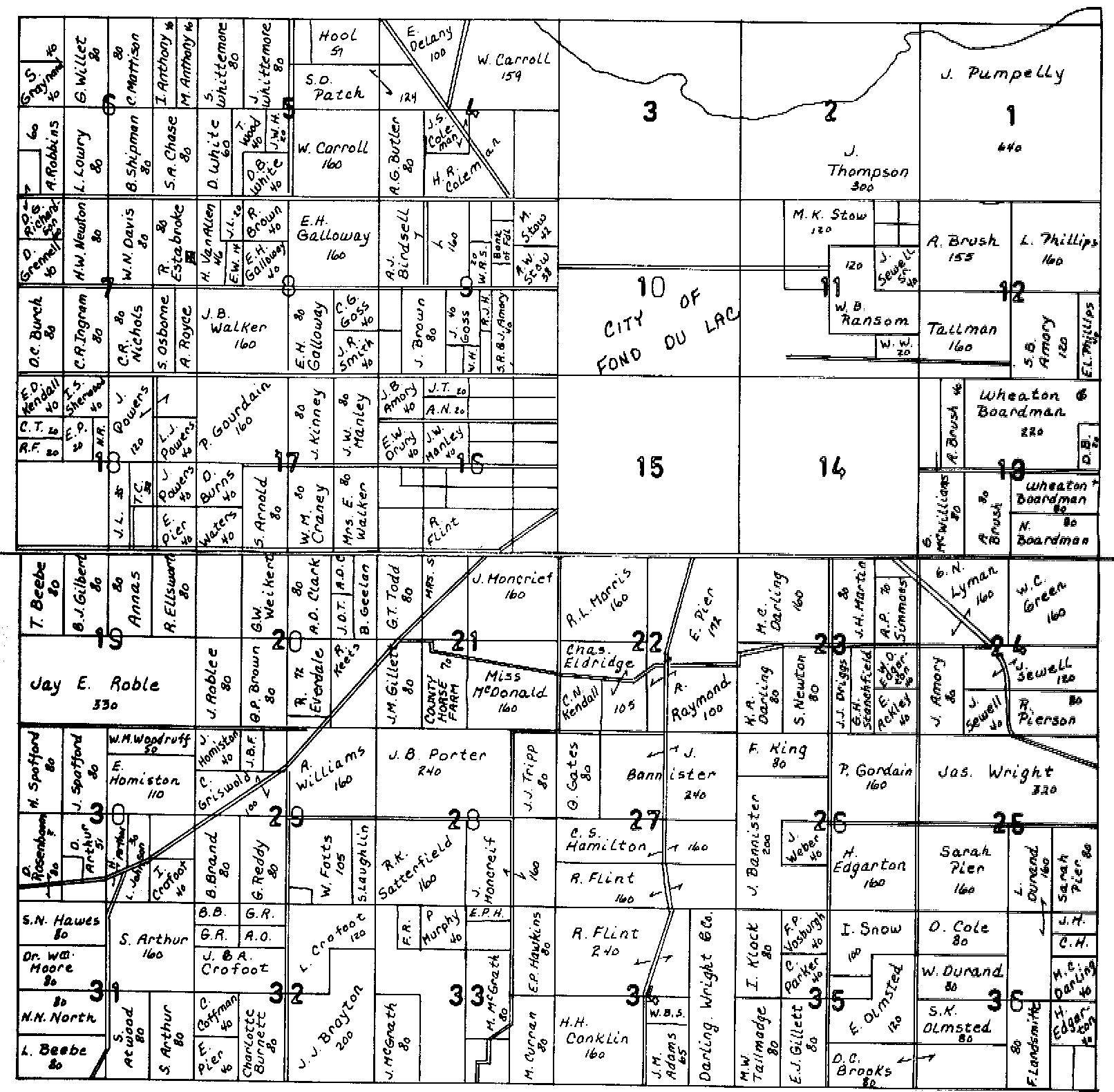
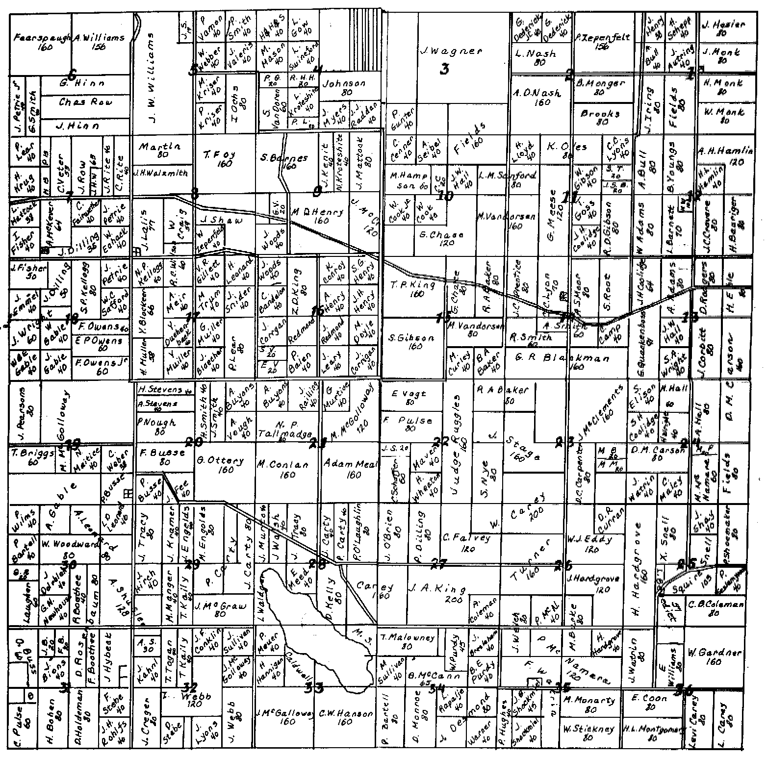
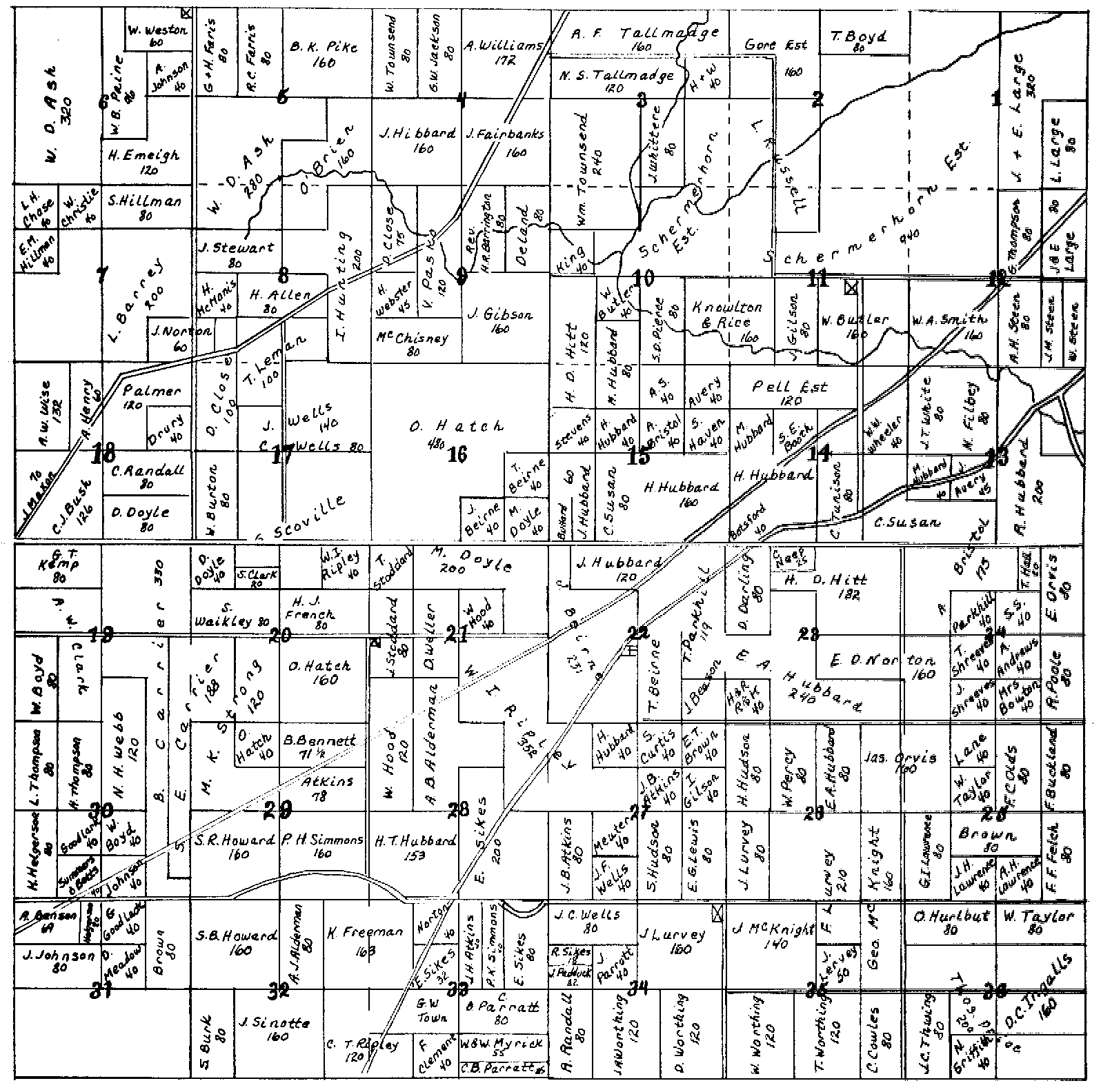
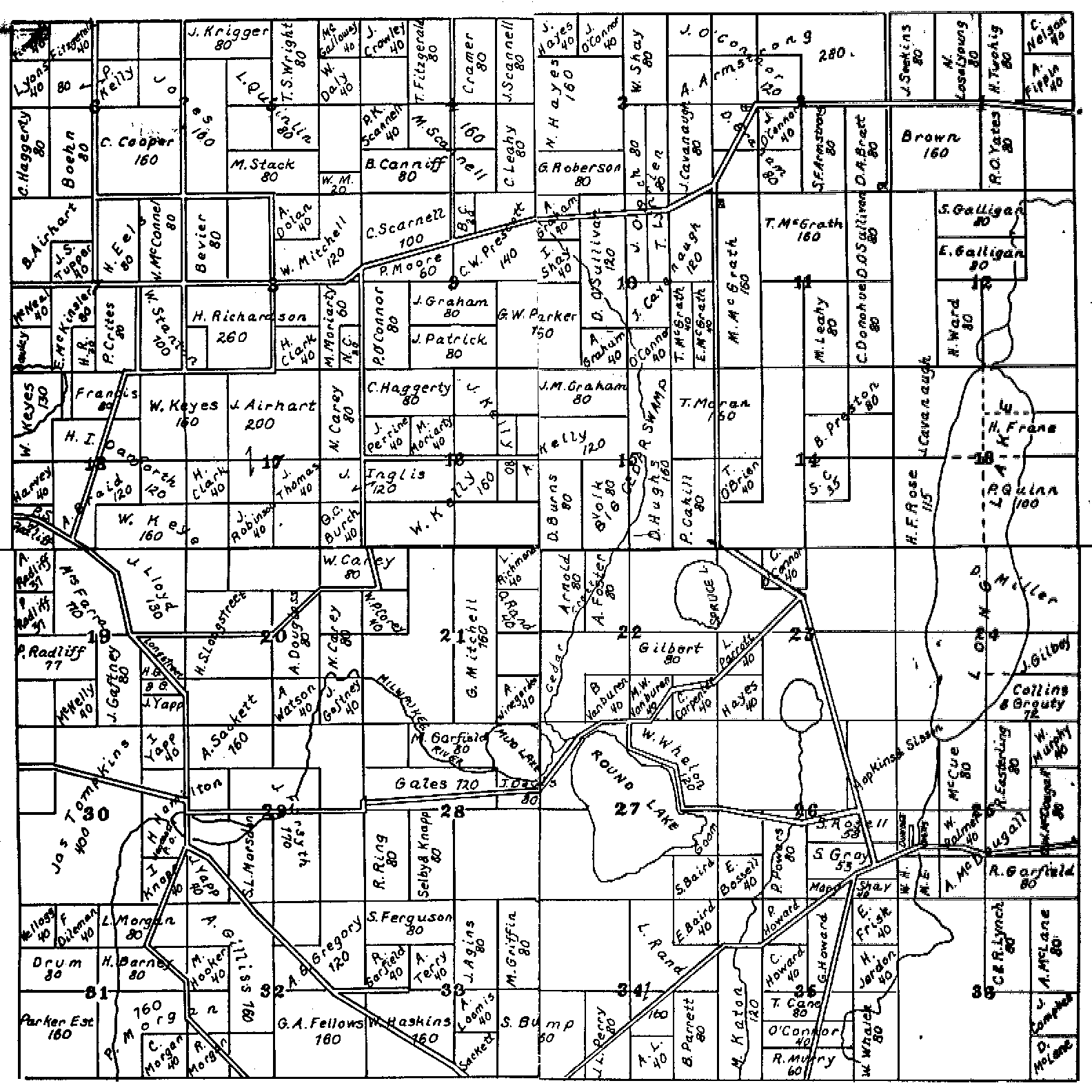
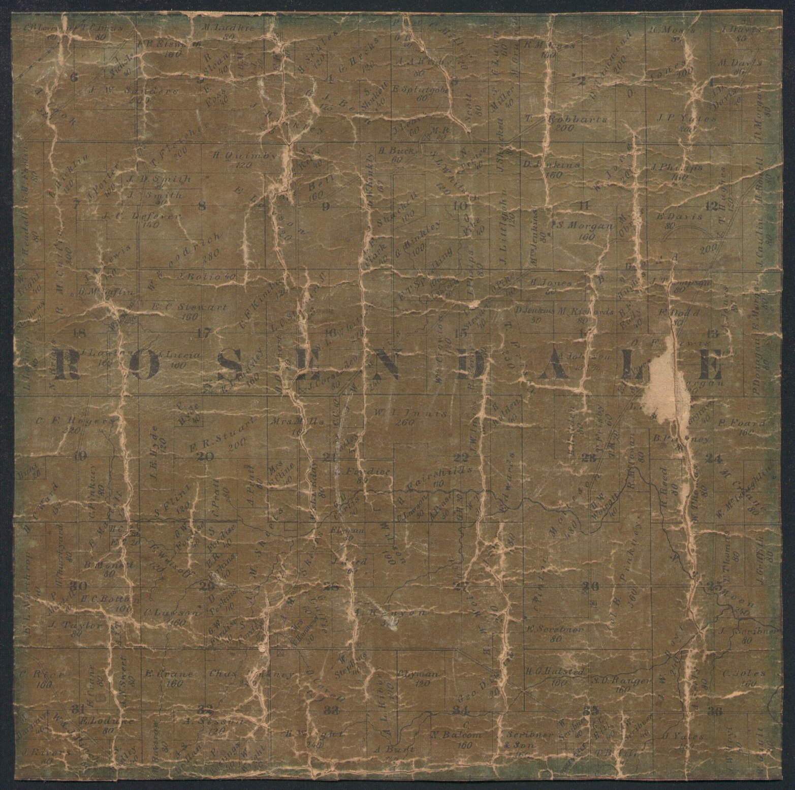
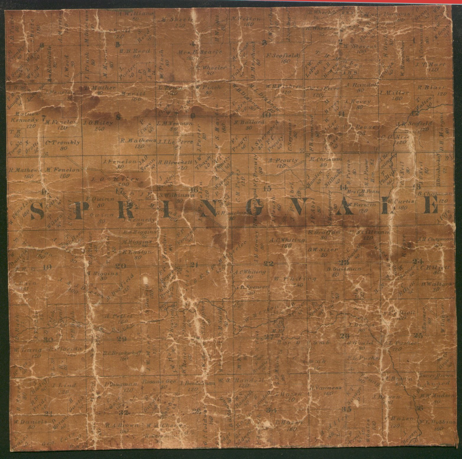
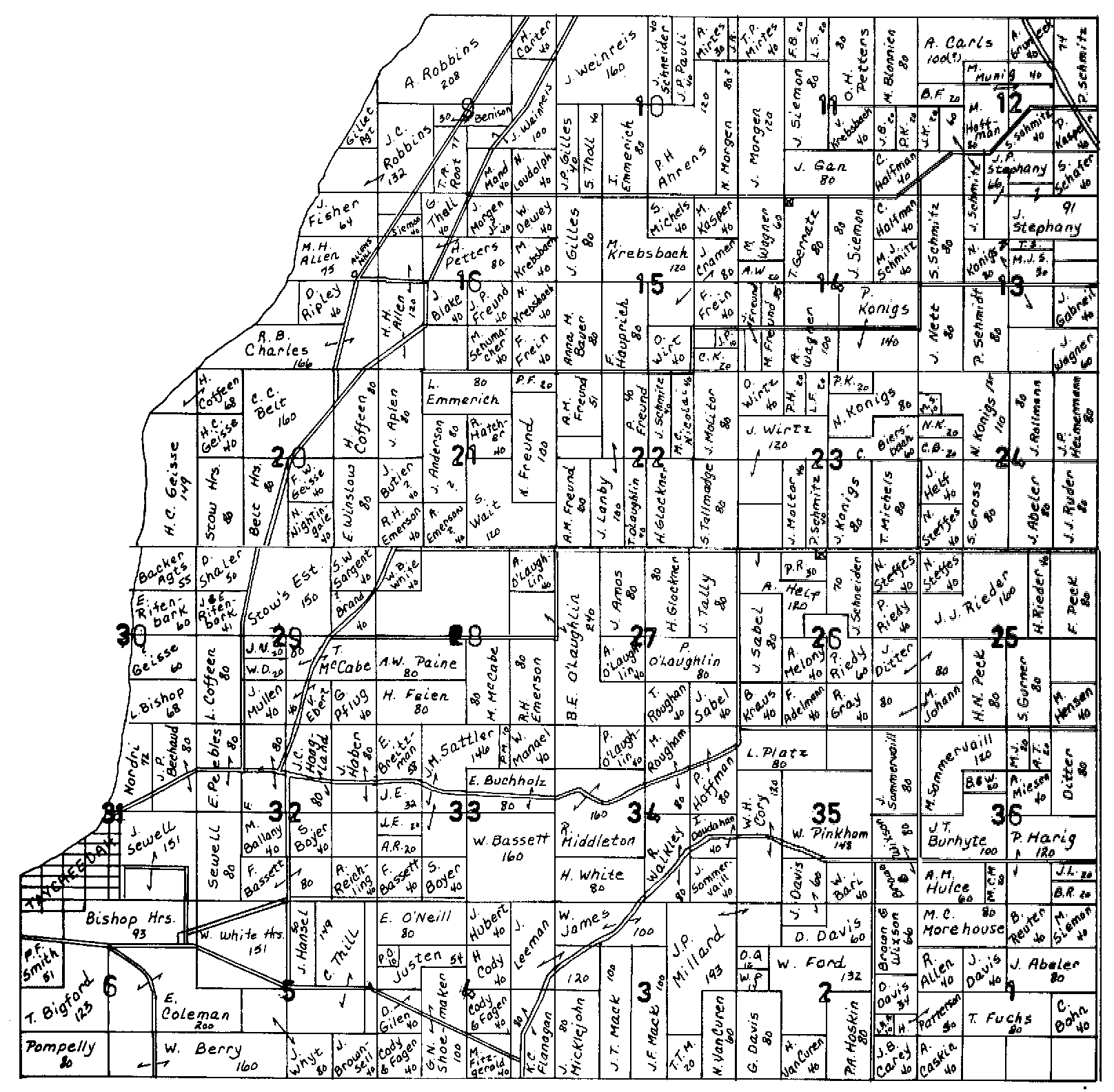
(ca.) 1862 Plat Map Fond du Lac County, Wisconsin |
||
|
|
The best way to view these plat maps,
is to save the township file to your computer,
and then open the file in a blank word processing document
for printing.
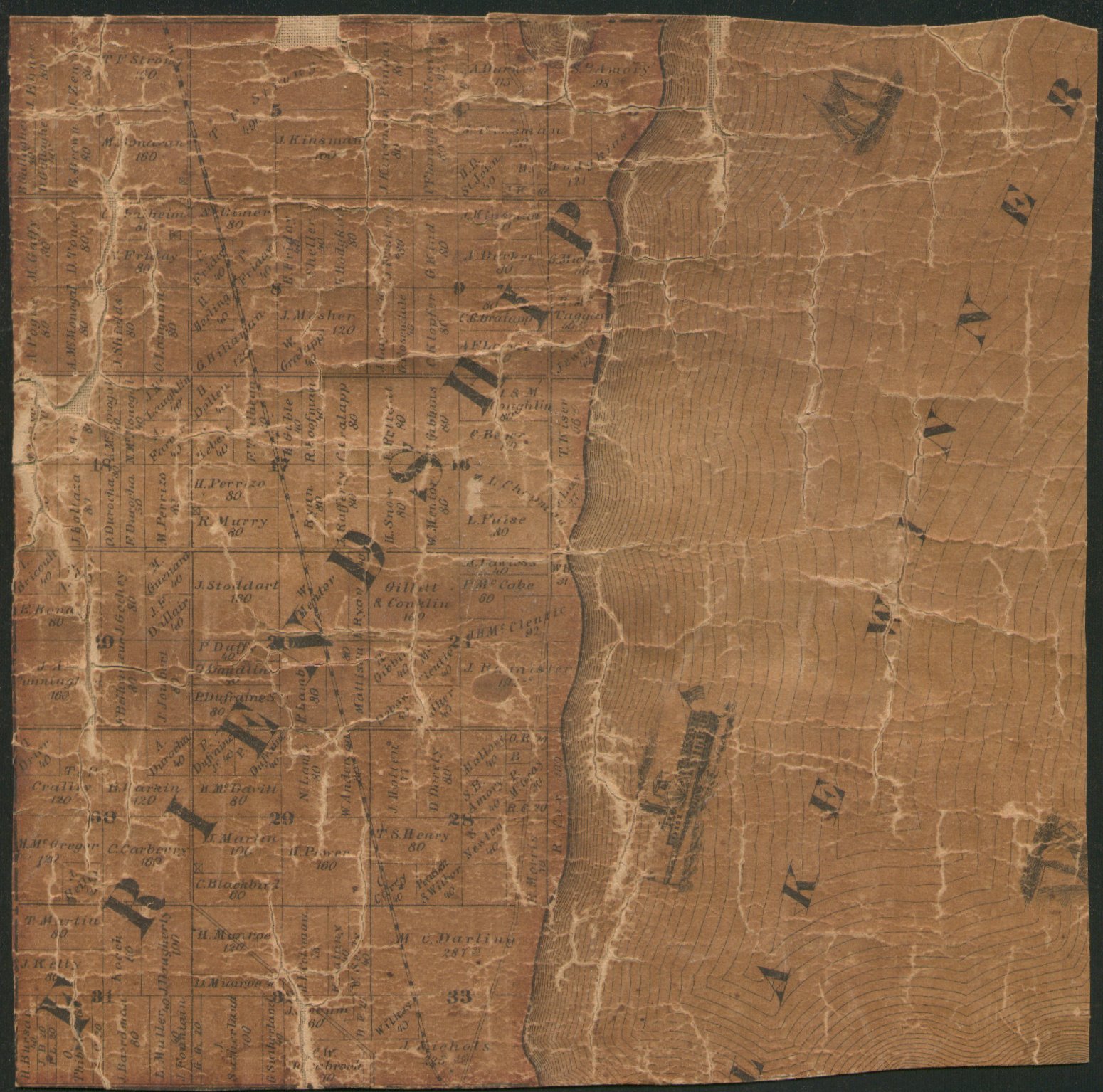
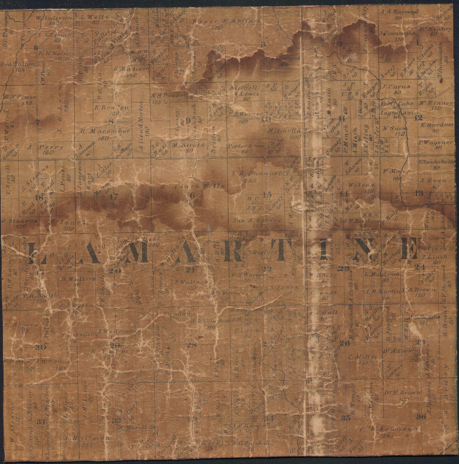
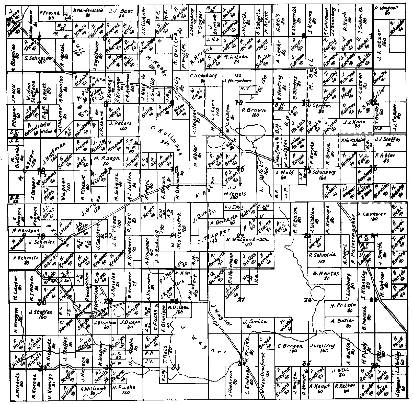
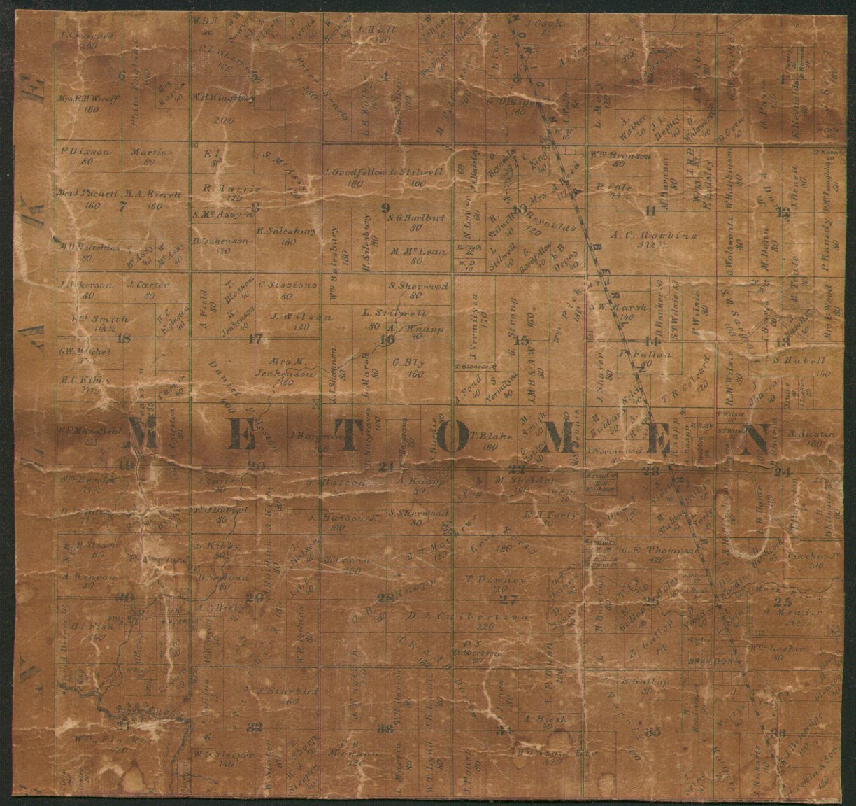
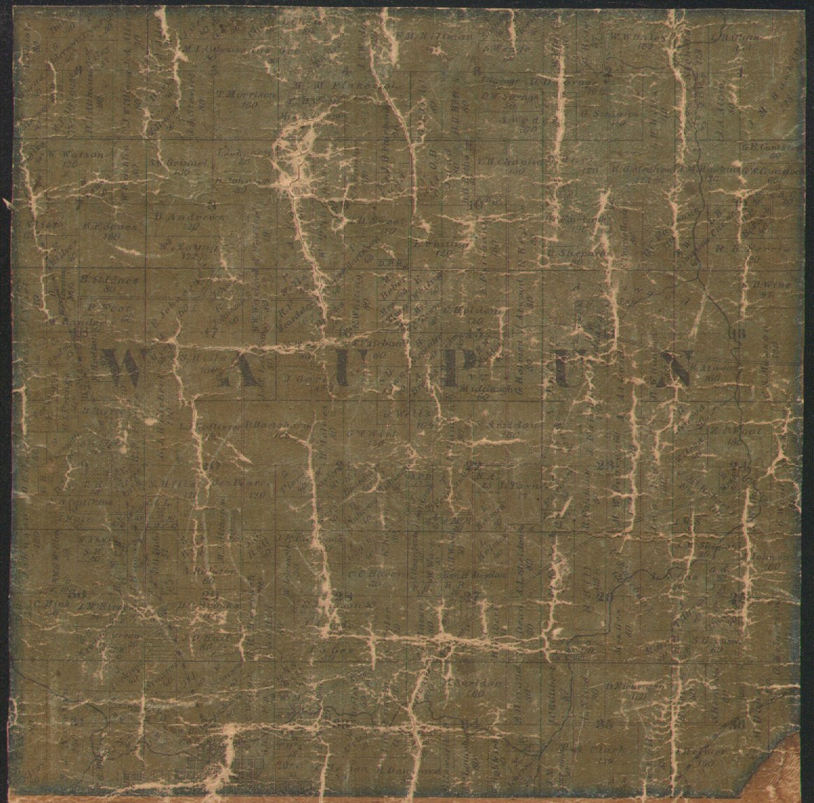
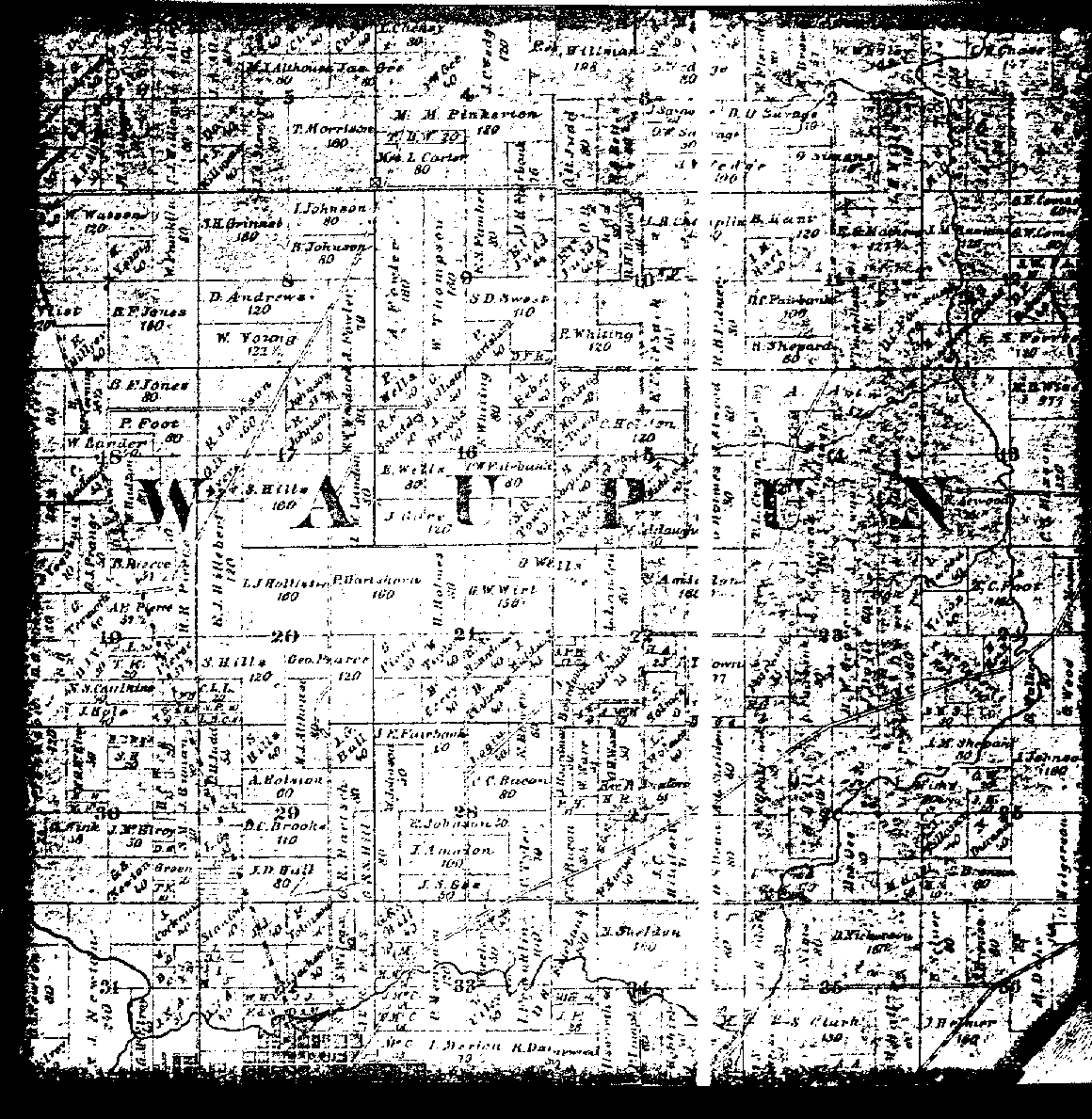
Some of the 1862 maps are reproductions of an original wallhanging (created ca. 1862) plat map of Fond du Lac County, Wisconsin Due to the difficulty in reading copies of the original wallhanging, some townships were re-drawn by myself in the 1980's, and currently have been scanned into a graphic format for viewing on the web. Where a reproduction has not been completed, the original has been scanned in. The date and publisher of the original wall map has never
been determined, but the approximate date of publication has been determined
to be ca. 1862. This is the first plat map of Fond du Lac county. The original
re-productions, created in 1980-81, are still in my possession. |
||
|
Return to 
|
Disclaimer | Privacy Statement These electronic pages may not be reproduced in this format for profit or presentation by any other organization or persons without the permission of WIGenWeb ** Ruth Shaw Worthing, The History of Fond du Lac County, as told by its Place-Names, 1976. ** The History of Fond du Lac County, Wisconsin, Chicago: Western Historical Company, 1880. ** Portrait and Biographical Album of Fond du Lac County, Wisconsin, Chicago: Acme Publishing Company, 1889. ** A. T. Glaze, Incidents and Anecdotes of Early Days and History of Business in the City and County of Fond du Lac from Early Times to the Present, Fond du Lac: P. B. Haber Printing Company, 1905. ** Maurice McKenna, ed., History of Fond du Lac County, Chicago: S. J. Clarke Publishing Company, 1912. ** Wisconsin Volunteers: War of the Rebellion 1861-1865 ** Plat Book of Fond du Lac County, Wisconsin, C. M. Foote & Co. 1893 |